Bismillah ir-Rahman ir-Rahim
....We headed up to Dunedin. So what's in Dunedin? Ive heard somewhere before that Dunedin is one of the spookiest place on earth. Not quite believing it, but yeah there are lots of old houses that look like dracula place in Dunedin. I dont really mind 'hantu mat saleh' because of their good look, obviously i will 'sengih' rather than 'lari lintang pukang'. Rugi la kalau lari. Remembering one of my friend's 'cerita hantu' which happened in Canberra that recent year. She told us that her other Malaysian friend saw a 'hantu pocong' in their backyard. Yes, 'hantu pocong' in Canberra, well you cant throw away Malaysian sense out of a Malaysian, can you? even hantu pun jadi hantu Malaysia even though in negara mat saleh.
Well anyway, Dunedin is the second largest city in New Zealand located in Otago region and it is home to the University of Otago. We have few Malaysians studying here. We even 'tumpang' Kak Azam's house (Jojet's friend who is studying in the University of Otago) for the night. Still remember that delicious Chicken Rice for dinner and Nasi Kerabu for lunch on top of Mount Cook. Thank you Kak Azam and friends!
 |
| Heading down to Dunedin |
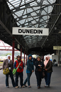 |
| Dunedin Railway Station, pose je, bukan naik ketapi pun.... |
 |
| Ala-ala Bangunan Sultan Abdul Samad tak? |
 |
| Kilang Cadbury yang tutup..alahay...nasib badan... |
 |
| Tunggu bas, tak sampai2. |
 |
| The Railway Station |
One of the main attractions of Dunedin is the Baldwin Street. It is world's steepest residential street located about 3.5km from the city centre. It is recorded to be slightly more than 1:5 gradient slope. For safety, some part of the road are surfaced with concrete to avoid chipped bitumen flow down the slope. There are few incidents that I read regarding the Baldwin Street. A University of Otago student died here while playing in a Wheelie Bin. Not a smart game though, the bin crashed with a trailer parked by the roadside. And, there was another silly incident involving three men who have nothing to do because the pub was closed; being charged with disorderly behaviour and dangerous driving after rode in a chilly bin towed behind a car down the street. Erti kata lain, dah takde keje ke bro?...
 |
| K.awan dah penat yo! |
 |
| Lepak di jalan... |
 |
| Boleh takk...siap dapat cert. |
 |
| Bukan rumah yg senget yer.... |
 |
| Me, cubaan nak golek, tapi terlompat puler... |
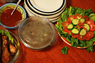 |
| Nasi ayam for dinner |
The next day, we headed up to Mount Cook, the highlight of our trip. From Dunedin we drove up to Omarama, Twizel and Lake Pukaki to the Mount Cook National Park. Before arriving in Omarama, we stopped by Lake Aviemore to enjoy the splendid view. Lake Aviemore is a man-made lake which was designed as part of Waitaki Hydroelectric scheme. From the main road, on the right side is the Aviemore Dam.
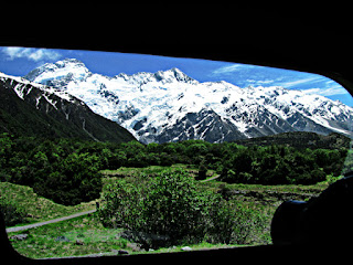 |
| Looking out.... |
 |
| Lake Aviemore |
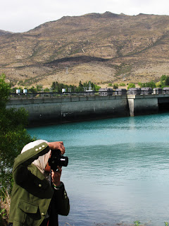 |
| Backdrop tuh adalah Aviemore Dam |
 |
| Ramai2 kacau Azlina Ismail posing...kesian.... |
|
|
|
 |
| Arriving in Mount Cook....posing dlu... |
Mount Cook is the highest mountain in New Zealand that stands at 3,754 metres (12,316 ft) and is also known as Aoraki, so...kalau tiba-tiba hangpa nampak nama Aoraki tu, jangan la kompius2. Aoraki is Maori name of a person which means, ao (world, daytime, cloud, etc.) and raki or rangi (day, sky, weather, etc.). I'm hoping that one day, I'll hike up Mount Cook. Will definitely listing it down in my mount hiking list.
 |
| Cobaan melompat Azlina Ismail |
 |
| Yang belakang tuh pun, bila suruh amik gambo, dok sedih2, tang posing tangan paling tinggi.... |
 |
| Nasi Kerabu dan Mount Cook |
 |
| Cantiknya la setting.... |
 |
| The Panorama view of Southern Alps. |
We spent the night in Lake Tekapo which is located about 100km from Mount Cook National Park. It's a small village, but the lake covers a massive area of 83km2. There is a famous church in Lake Tekapo. Church of Good Shepherd was the first church being built in Mckenzie area in 1935. It is said to be the most photographed church in New Zealand. Been there, and I totally agree, that the statement is true. The setting of the church is so beautiful, perched next to the lake with an altar window framing the lake and its backdrop mountain.
 |
| Church of Good Shepherd |
 |
| Hahahha...layankan.... |
 |
| Silap la posing gitu jet oi....camouflage terus dgn bunga |
 |
| This is the best gambar lompat of me. |
 |
| Oh, this one to...~ |
 |
| Lake Tekapo from our hostel |
 |
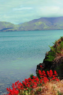
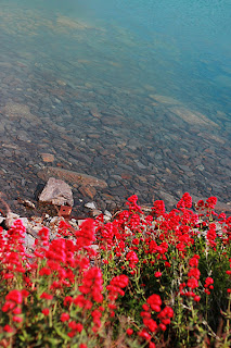
| Lake Tekapo near Church of Good Shepherd. |


