Bismillah ir-Rahman ir-Rahim
Been planning for this trip for 2 years, and finally….yup!
finally! Originally, it was mine and liyana's idea. Konon2 nak camping kat outback, tapi masa tuh, hanya berdua lagi, belum bertiga. But this time around, tambah Kak G sorang lagi. So, the three of us, headed down to the outback of Flinders Ranges, to Wilpena. We started our journey around 8am, preparing for at least a 5hour drive from Adelaide city. The best scenic route is through the Clare Valley, Laura, Orroroo, Quorn and Hawker towards Wilpena.
Flinders Ranges is in the outback of South Australia and it is the largest continous mountain range in South Australia that stretch for 430km. Highlight untuk Flinders Ranges ni adalah The Wilpena Pound. And this is where we are heading. The highest peak is the St Mary's Peak that stands at 1170m. We decided to hike the Mount Ohlssen Bagge instead of St Mary's Peak because we can spend a lot of time not just hiking to the peak but also experiencing the pound from lower land.

 |
| The Ranges |
Wilpena Pound is a natural amphitheatre surrounds by a range of mountains. The pound is a popular hiking destination for all levels of fitness. Most of the walking trails starts from the visitor centre.
 |
| The Elder Range |
 |
| Our dapur... |
 |
| Gambar wajib! |
 |
| Pasang khemah |
 |
| Pasang khemah and setup dapur... |
 |
| Liyana having brekkie |
 |
| Lunch atas batu.... |
|
|
|
We arrived in Wilpena around 3pm, set up our tent then
off to the Sacred Canyon about 20km from the Wilpena visitor centre. Along the way to the Sacred Canyon, we passed through unpaved road with wild kangaroos jumping around. The Sacred
Canyon is where you can find examples of Aboriginal engravings with symbols of circles
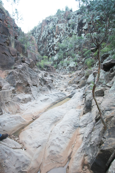
and lines that was said to depict campsites, waterholes and etc.What i like the most about the Sacred Canyon trail is its dry river bed form.
 |
| Cute kan? |
 |
| 12km from here... |
 |
| The starting point |
 |
| The first waterfall... |
 |
| ...and me! cool tak? ngeehehehe. There are circle marks at the rock, the petroglyph. |
 |
| Helping hand.. |
 |
| I like this part... |
 |
| The second fall... |
 |
| And the big red gum tree, yang telah membelah dirinya sendiri? takjub kan? hehehe |
 |
| Preparing for dinner. |
The next day, we decided to hike Mount Ohlssen Bagge to get overall view of Wilpena Pound. It was listed as Hard as we have to hike through steep and rocky inclines and of about 6.9km return. It took us at least 2 hour (plus lots and lots of phototaking session) to hike up and 45 minutes coming down. Total 2.5 hour return.
 |
| The starting point |
 |
| Mini petai? ok, dah sangap, perlu balik the 'petai' land dgn segera. |
 |
| Straight forward linear trail. Ini baru start je, kitorang memang banyak tertipu la, ingat dah nak sampai rupanye, summit kat belakang lagi, dan lagi dan lagi, total tertipu = 3 kali. |
 |
| Steep trail |
 |
| Gaya peneroka |
 |
| Most of mountain trails in Australia will have this kind of direction mark. Senang kan? yakin tak sesat! |
 |
| ...and this kind of arrow tooo... |
 |
| sikit lagi.... |
 |
| Arrow ni pun cool, sekali dengan reflector untuk hiking malam2. |
 |
| Antara session yang membuatkan kami 'pause' mendaki kejap. |
 |
| Asal pokok ni muncul je, tau dah, dah nak sampai summit. |
 |
| ...and, Yay! |
 |
| Gaya lion king kan? hihihihihi |
 |
| The Pound |
 |
| Mount Ohlssen Bagge |
I wished that we have the time to hike up to St Mary's Peak, which is the highest peak of the range for a better view. But, well, this will do for now, it was a good hike and a great experience for us. Really enjoyed this trip, hopefully we can spend more time together doing this sort of thing. Oh yeah, lagu tema adalah lagu Ramlah Ram - Kau kunci hati ku........hmmm....(oh my...its playing in my head now...).